Property Record
7200 Bunton Rd, Ypsilanti, MI 48197

NEARBY LISTINGS FOR SALE OR LEASE
-
-
View all Ypsilanti listings for sale on LoopNet.com
Property Detail
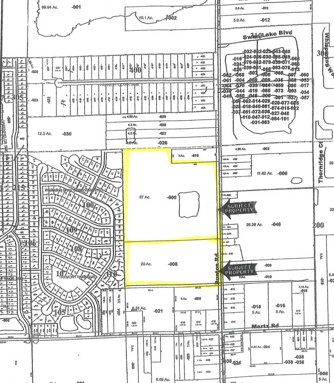
7200 Bunton Rd
11-35-100-009
YP#35-1A :THE NE 1/4 OF NE 1/4 SEC 35 T3S-R7E EXC THE FOLLOWING: BEG AT A POINT DISTANT 33 FT FROM NE COR, TH S 198 FT, TH S
Residentialacreage
Washtenaw
X
Michigan
26161C0440E
37 AC
0
Washtenaw E of 23
2025
Detroit
413200
Ann Arbor, MI
DEMOGRAPHICS near 7200 Bunton Rd
1 Mile
3 Mile
5 Mile
2024 Total Population
4,651
34,467
76,527
2029 Population
4,621
34,108
75,423
Pop Growth 2024-2029
(0.65%)
(1.04%)
(1.44%)
Average Age
37
39
39
2024 Total Households
1,654
13,584
32,124
HH Growth 2024-2029
(0.67%)
(1.11%)
(1.55%)
Median Household Inc
$80,560
$78,613
$59,911
Avg Household Size
2.80
2.50
2.30
2024 Avg HH Vehicles
2.00
2.00
2.00
Median Home Value
$226,000
$222,590
$199,999
Median Year Built
2001
1989
1974
Nearby Places
Map Layers
Map Styles
 Street
 Aerial
- Restaurants
- Banks
- Shops
- Fitness
- Groceries
PUBLIC TRANSPORTATION
AIRPORT
Detroit Metro Wayne County
DRIVE
WALK
Distance
Detroit Metro Wayne County
24 min
16.2 mi
Freight Ports
Port of Toledo
DRIVE
WALK
Distance
Port of Toledo
74 min
57.8 mi
SALE & LEASE HISTORY
LISTING DATE
SALE/LEASE

Sep 24, 2016
For Sale
Nearby Properties
Address
Land Use
TOTAL SIZE
Lot Size
Zoning
Address
Land Use
TOTAL SIZE
Lot Size
Zoning
38,001 SF
177.04 AC
BA
Address
Land Use
TOTAL SIZE
Lot Size
Zoning
11,847 SF
91.35 AC
II
Address
Land Use
TOTAL SIZE
Lot Size
Zoning
97.69 AC
Address
Land Use
TOTAL SIZE
Lot Size
Zoning
19,692 SF
21.22 AC
BA
Address
Land Use
TOTAL SIZE
Lot Size
Zoning
12,747 SF
17.90 AC
BA
Address
Land Use
TOTAL SIZE
Lot Size
Zoning
1,960 SF
59.97 AC
Address
Land Use
TOTAL SIZE
Lot Size
Zoning
4,636 SF
18.91 AC
Address
Land Use
TOTAL SIZE
Lot Size
Zoning
161,042 SF
26.29 AC
II
Address
Land Use
TOTAL SIZE
Lot Size
Zoning
12,747 SF
7.37 AC
BA
Address
Land Use
TOTAL SIZE
Lot Size
Zoning
126,711 SF
12.74 AC
Address
Land Use
TOTAL SIZE
Lot Size
Zoning
29,610 SF
9.10 AC
BA
Address
Land Use
TOTAL SIZE
Lot Size
Zoning
12,747 SF
6.25 AC
BA
Address
Land Use
TOTAL SIZE
Lot Size
Zoning
134,499 SF
6.20 AC
BA
Address
Land Use
TOTAL SIZE
Lot Size
Zoning
1,744 SF
41.75 AC
BI
Address
Land Use
TOTAL SIZE
Lot Size
Zoning
72,834 SF
4.97 AC
RM MULT
Address
Land Use
TOTAL SIZE
Lot Size
Zoning
1,680 SF
20 AC
II
Address
Land Use
TOTAL SIZE
Lot Size
Zoning
54.32 AC
RMH MOB
Address
Land Use
TOTAL SIZE
Lot Size
Zoning
80.11 AC
Address
Land Use
TOTAL SIZE
Lot Size
Zoning
89,778 SF
9.65 AC
C1 GEN
Address
Land Use
TOTAL SIZE
Lot Size
Zoning
51,840 SF
9.07 AC
Address
Land Use
TOTAL SIZE
Lot Size
Zoning
16,414 SF
7.66 AC
BA
Address
Land Use
TOTAL SIZE
Lot Size
Zoning
4,442 SF
42.38 AC
RMH MOB
Address
Land Use
TOTAL SIZE
Lot Size
Zoning
224,938 SF
19.42 AC
C1 GEN
Address
Land Use
TOTAL SIZE
Lot Size
Zoning
35,440 SF
12.36 AC
Address
Land Use
TOTAL SIZE
Lot Size
Zoning
6,000 SF
15 AC
DI
Address
Land Use
TOTAL SIZE
Lot Size
Zoning
35.89 AC
RMH MOB
Address
Land Use
TOTAL SIZE
Lot Size
Zoning
20 AC
DI
Address
Land Use
TOTAL SIZE
Lot Size
Zoning
8,580 SF
28.50 AC
Address
Land Use
TOTAL SIZE
Lot Size
Zoning
5,515 SF
89.67 AC
BLANK
Address
Land Use
TOTAL SIZE
Lot Size
Zoning
1.25 AC
The World's #1 Commercial Real Estate Marketplace
Connect with us
© 2025 CoStar Group
The information above has been obtained from sources believed reliable. While we do not doubt its accuracy we have not verified it and make no guarantee, warranty or representation about it. It is your responsibility to independently confirm its accuracy and completeness. Any projections, opinions, assumptions, or estimates used are for example only and do not represent the current or future performance of the property. The value of this transaction to you depends on tax and other factors which should be evaluated by your tax, financial, and legal advisors. You and your advisors should conduct a careful, independent investigation of the property to determine to your satisfaction the suitability of the property for your needs.